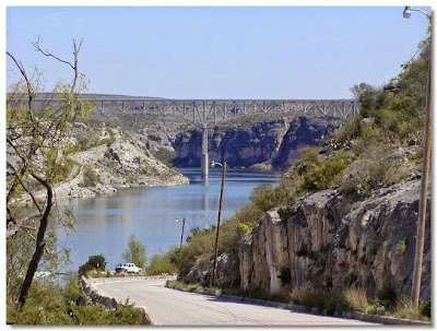
Situated on the United StatesMexico Border, AmistadNational Recreation Area is known primarily for excellent year round, waterbased recreation including: boating, fishing, swimming, scuba diving and waterskiing. Amistad NRA also provides opportunities for picnicking, camping and hunting. The reservoir, at the confluence of the Rio
Grande, Devils and Pecos rivers, was created by Amistad Dam in 1969. In addition to excellent recreation, this area is rich in archaeology and rock art, and contains a wide variety of plant and animal life.
 |
Almost immediately as we headed into the river, we noticed the raptors overhead. This is a vulture and the
next is after he landed high overhead on the cliff.
|
 |
The first of the caves is known as Parida Cave and was first occupied some
10,000 years ago. It is smaller and less dramatic than the Panther Cave
we would see later.
|
 |
This is one of the clearest of the paintings in this cave.
|
 |
Unfortunately, the step out of the boat was a little too high for
Cathy to try with her back problem so she enjoyed the sun and
scenery from the boat on this cave.
|
 |
The next three pictures are of more paintings in Parida Cave.
|
 |
This shows the left portion of the painting. Later pictures will attempt to
capture the actual paintings of each major segment in more detail.
|
 |
| The image of the Panther gives this cave its name. The painting is at least 15 feet wide. |
 |
Natural weathering has faded some of the paintings
at the left, so they are pretty faint and hard to see.
|
 |
 |
| It appears this Shaman has either a sacrifice or perhaps the results of a hunt in his right hand. |
 |
And this is the cave's namesake Panther - just spectacular to see.
|
 |
After leaving Panther Cave we headed back out to the river to explore.
|
 |
I thought this naturally eroded cave on the cliff looked as if it had been professionally
landscaped with native plants. But it is really just an example of Mother Nature's landscaping.
|
 |
Nests high on the cliffs of the Pecos River.
|
 |
Osprey in flight.
|
 |
Osprey.
|
 |
Way up there on the cliffs, we saw several farm goats out browsing.
From the river it is impossible to see how they got there, but goats are
curious, sure-footed and undeterred by such obstacles.
|
 |
| A closer look at the goats here and below. |
 |
Another eroded cave in the cliff face. This is on the Pecos River in Texas.
|
 |
A Blue Heron takes a break from fishing.
|
 |
| Our boat Captain on the Left along with two fellow tourists we met at the visitor center and shared the cost of the rental. Cathy on right - I was behind the camera! |
 |
A little history of the Southern Pacific Transcontinental
Railroad in the area. This is at a picnic shelter above the boat launch ramp.
|
 |
Is Cathy looking for the train?
|
 |
As we were leaving in the car, we saw these Turkey Vultures in the parking lot.
They stayed just long enough for me to take their picture for you.
|


